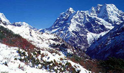
 The bulk of Mera, officially the highest of Nepal's permitted trekking peaks, rises to the south of Everest and dominates the watershed between the wild and heavily wooded valleys of the Hinku and Hongu Drangkas and is not truly speaking part of the Khumbu Himal. It should also be noted that there is a discrepancy between the official height given by the NMA (6654m) and the Schneider Map (6476m). The bulk of Mera, officially the highest of Nepal's permitted trekking peaks, rises to the south of Everest and dominates the watershed between the wild and heavily wooded valleys of the Hinku and Hongu Drangkas and is not truly speaking part of the Khumbu Himal. It should also be noted that there is a discrepancy between the official height given by the NMA (6654m) and the Schneider Map (6476m).
The first ascent of Mera was, made by J.O.M. Roberts and Sen Tenzing on 20 May 1953, by the now standard route from the Mera La. It was during this season that Roberts made the first western exploration of the Lumding, Hinku (Inukhu) and Hongu valleys. It would appear that Mera did not receive a subsequent ascent until 1978 when French climbers Marcel Jolly, G. Baus and L. Honills climbed the North Peak, following the same route as Roberts but traversing along the connecting ridge to the further summit.
Both the Hongu and Hinku valleys remain uninhabited although there are kharka in the upper Hinku basin where Sherpa from the south, near Pangkongma, graze their animals during the grass-growing monsoon.
By its standard route from the Mera La, the ascent is technically straightforward; however, after a heavy fall of snow or when the maze of crevasses are open, the way can be long and demanding. Far and above the most rewarding aspect of a trip to Mera is a chance to venture into a little-visited and as yet unspoilt region of Nepal where the hillsides are still densely forested and a need to be self-sufficient is essential. There is also, of course, the pleasure of going above 6000m.
There are many approaches to Mera; none are easy and some require the crossing of high and difficult passes, making a trek to the peak a real mountaineering adventure for which effort is rewarded with spectacular scenery and ultimately one of the finest viewpoints in Nepal.
The upper Hongu Basin is truly a mountain wilderness, a place of massive moraines, glacial lakes and spectacular peaks that include Chamlang and Baruntse. The valley terminates in a crescent of ridges, peaks and passes that includes West Col (6135m), Amphu Labtsa (5780m) and the Mingbo La (5817m). All of these crossings provide magnificent, albeit difficult, entries and exits to and from the Hongu Basin. Interestingly, a group of lakes (generally referred to as Panch Pokhri) set just below the Amphu Labtsa and near the snout of the Mingbo Nup Glacier on the approach to the Mingbo La is a sacred site and a place of pilgrimage.
About the passes, the Mingbo La is the most direct to Khumbu, and the least dangerous. The landscape is superb; all above 5.000 metres, with constant views of magnificent mountains, dominated in the last few days by Ama Dablam. The Khumbu side of the Mingbo La is quite steep as you descend between ice flutings for about 100 meters, with the final glacier section through the seracs of the Mingbo Glacier quite stunning. A further day descending moraines below the South-West Face of Ama Dablam leads to Pangboche and the main Everest Base Camp trail. Expect to take three days to travel from base camp to a camp on the Hunku Nup Glacier, on the East Side of the Mingbo La, with a further two days to Pangboche. |


 The bulk of Mera, officially the highest of Nepal's permitted trekking peaks, rises to the south of Everest and dominates the watershed between the wild and heavily wooded valleys of the Hinku and Hongu Drangkas and is not truly speaking part of the Khumbu Himal. It should also be noted that there is a discrepancy between the official height given by the NMA (6654m) and the Schneider Map (6476m).